
Bayesian Estimation of Phylogeographic History
(in development)
Incorporating the statistical model into a Bayesian framework will greatly enhance its utility by: 1) allowing prior information (e.g. known geographic constraints on the species’ range) to be utilized, 2) making hypothesis testing more powerful, and 3) making quantification of uncertainty more intuitive, by providing a posterior probability distribution for the estimates instead of maximum-likelihood point estimates. Moreover, the Bayesian implementation will overcome the limitations of previous methods by providing the first framework to utilize continuous geographic data from diverse sources and by allowing biologists to ascertain uncertainty in phylogeographic history without sacrificing computational tractability.
My aim will be to design PhyloMapper 2 such that biologists will be able to test a diversity of explicit hypotheses about historical routes of migration, refugia, and geological factors contributing to speciation. The primary output from the software PhyloMapper 2 will be the joint posterior probability distribution of the locations of the ancestors (represented by internal nodes on a phylogeny) of a given sample (represented by the tips), and the dispersal distance per time.
At least three types of data will be accommodated in PhyloMapper 2: phylogenetic, ecological, and geological. One type of ecological data that will be accommodated, for example, is ecological niche information from MaxEnt (Phillips 2006). MaxEnt uses sampling localities, climatic data at those localities, and a maximum entropy model to estimate the potential geographic range of the sampled species. Data from this program can be interpreted as the probability that an individual can survive at each point in geographic space. These probabilistic data will be used in the statistical model implemented in PhyloMapper to improve estimates of phylogeographic history (by limiting ancestors to realistic locations). PhyloMapper 2 will also accommodate geological data, in the form of a raster layer (created in ArcView, for example). Raster layers will provide information about the locations of rivers, mountains, and oceans, etc. These data will be used to set geographic constraints for hypothesis testing or to set priors on the geographic location of ancestors (see below).
Users of PhyloMapper will test alternative geographic hypotheses using constraints that they specify a priori. To test two alternative hypotheses of refugia, for example, a user could import two GIS layers into PhyloMapper, each of which delineates a different proposed refugium. By performing two analyses, each with a different layer used to impose a constraint for the ancestral location, the user could estimate the posterior probability distributions corresponding to the two alternative hypotheses. These two distributions could be compared using Bayes Factors to determine whether the data are significantly more likely under one of the two hypotheses.
Interested in helping me
develop PhyloMapper2?
Click Here
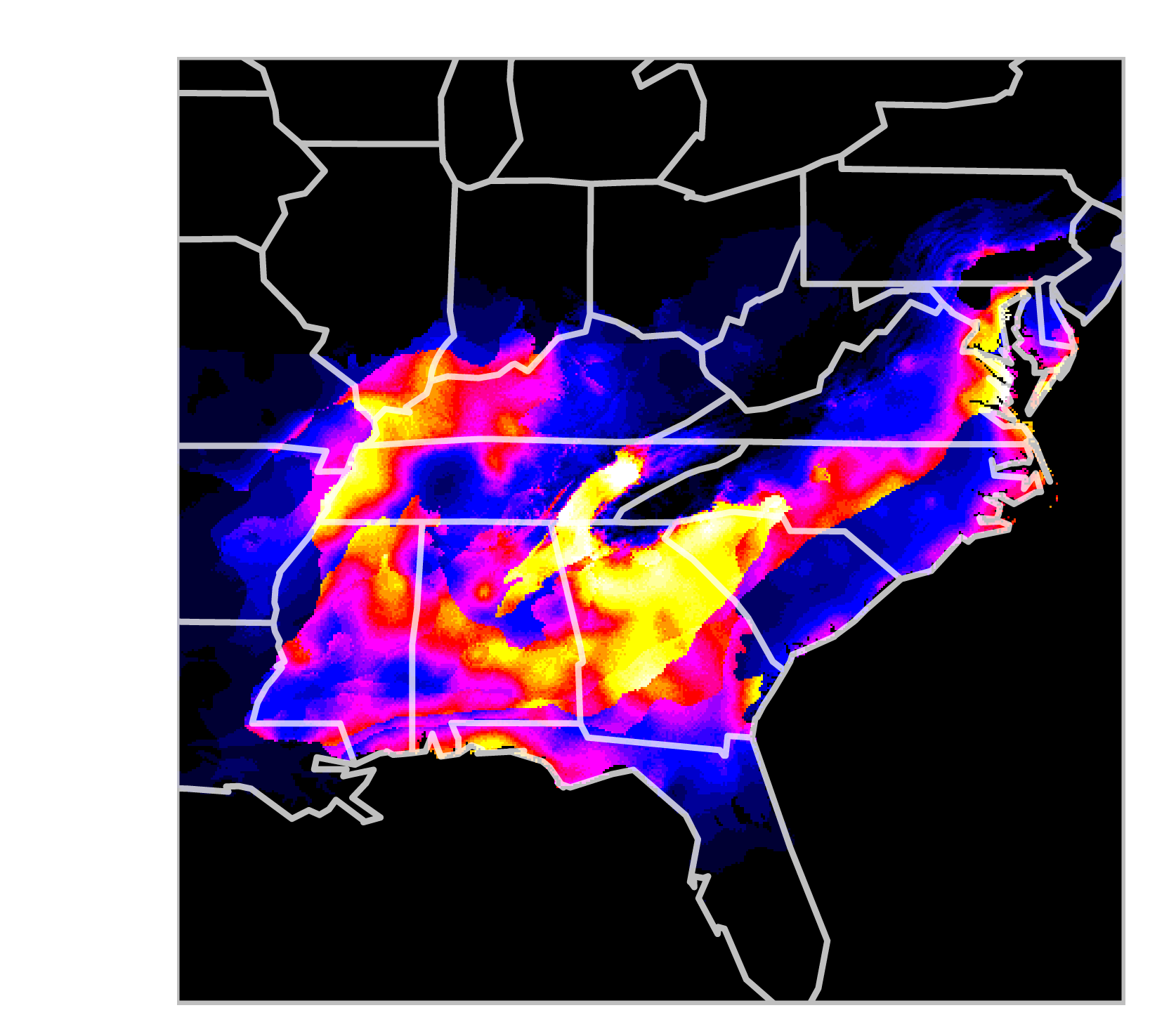
Environmental Suitability Data
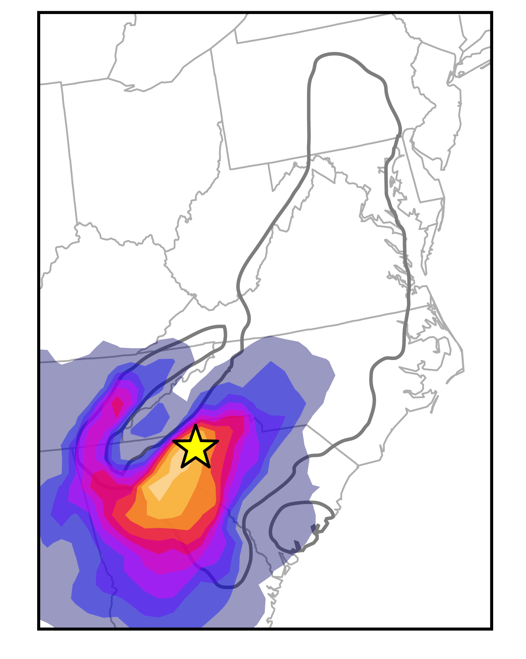
Posterior Distribution for the Location of the Ancestor
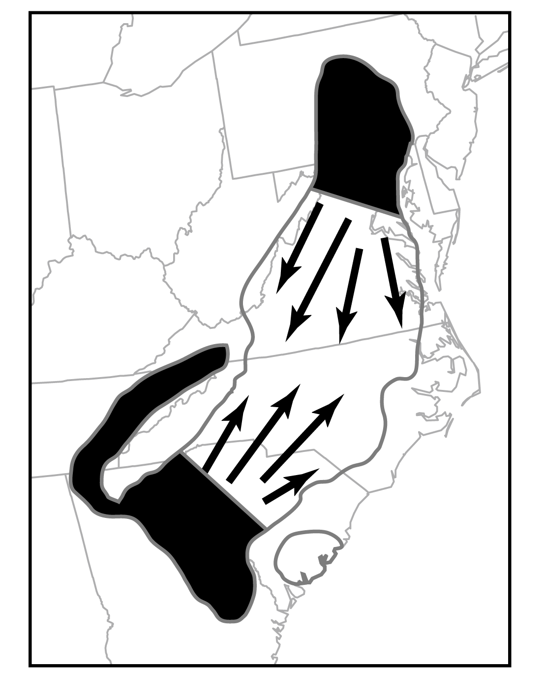
Hypothesized Refugia